Changbaishan: Volcano, Crater Lake, and Four Seasons on China’s White Mountain
🏔️ Volcanic caldera · Crater lake · Manchu sacred mountain · China–North Korea border
At a Glance
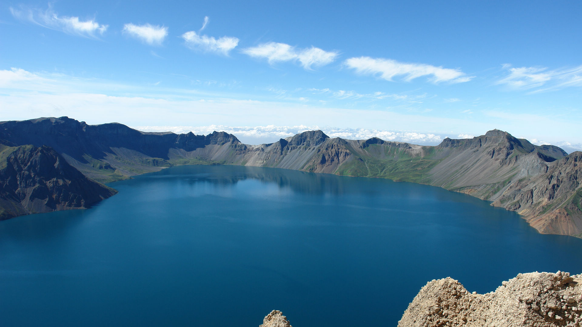
- Altitude: 2,744 m above sea level
- Type: Stratovolcano, still active
- Last eruption: 1903 (minor); 1702 (major)
- Tianchi: Deepest alpine lake in China — 373 m deep, surface area 9.82 km²
- Status: UNESCO Global Geopark, Manchu/Qing dynasty sacred mountain
- Visibility: Only about 30% of visitors see the lake — cloud cover is common
I came here in August and almost didn’t see Tianchi. Three hours of waiting at the summit, fog thick as soup. Then the wind shifted and the lake appeared for maybe twenty minutes before clouds rolled back in. I’ve heard people who visit five times still haven’t caught a clear view. That’s the honest reality of this place — it’s not a guarantee, it’s a lottery. And when you do see it, the payoff is enormous.
🌋 Geology & Formation
Card: The Volcano
| Field | Detail |
|---|---|
| Age | ~2.7 million years |
| Caldera diameter | ~4.5 km (E–W) × 5.5 km (N–S) |
| Rim height | 200–500 m above lake surface |
| Activity | Fumaroles and seismic activity detected regularly |
| Volcanic Explosivity Index | VEI 7 (mega-colossal) during the Millennium Eruption, 946 AD |
| Nearest city | Baishan (白山), 230 km southwest |
The mountain you see today sits inside the scar of the Millennium Eruption — one of the largest volcanic events in the last 2,000 years. Ash from that eruption reached Japan. The caldera filled with groundwater and snowmelt to form Tianchi.
Card: Tianchi (Heavenly Lake)
| Field | Detail |
|---|---|
| Elevation | 2,189 m |
| Depth | 373 m (deepest alpine lake in China) |
| Surface area | 9.82 km² |
| Water temperature | Avg 0.7°C year-round |
| Border | China (west/north) · North Korea (east/south) |
| Best viewing | June–September, mornings before 10 AM |
| Visibility rate | ~30% on any given day |
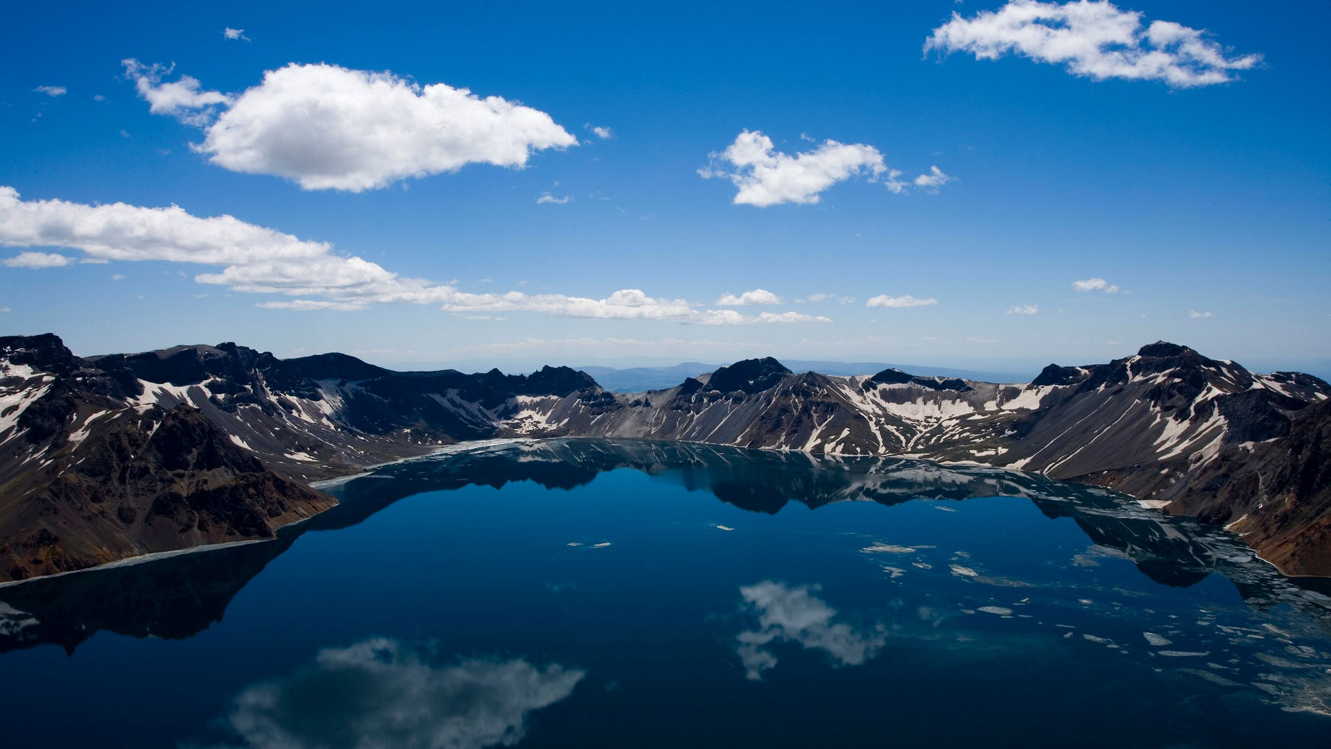
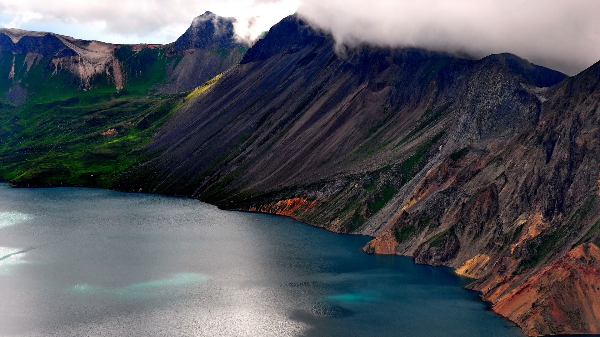
The lake sits in the caldera like an eye staring at the sky. On a clear day the water is an almost unnatural blue-green, rimmed by volcanic rock and 16 peaks. The highest, Baitou Peak (白头峰), reaches 2,744 m.
Two countries share this lake. The Chinese side has a developed viewing platform with a short hike up. The North Korean side is largely inaccessible to tourists. You’ll see their flag from the Chinese overlook.
Tip: Go early. The first cable car up at 6:30 AM has the best odds of clear skies. By noon, clouds usually close in.
🌊 Key Attractions
Card: Changbai Waterfall
| Field | Detail |
|---|---|
| Height | 68 m |
| Source | Outflow from Tianchi |
| Drop | Free fall into a gorge |
| Viewing | Year-round, but most impressive in summer |
| Distance from lake | ~1 km downstream |
| Access | Walking trail from Tianchi viewing platform |
Water from Tianchi pours over the eastern rim through a narrow gap called the “Dragon Gate.” The falls are tallest after summer rains and during spring snowmelt. In winter they partially freeze — the ice formations are something to see.
I wasn’t expecting much from a waterfall after seeing the lake, but the scale surprised me. Standing at the base, the spray is cold even in August. Bring a rain jacket.
Card: Hot Springs
| Field | Detail |
|---|---|
| Temperature | 60–80°C at source |
| Water type | Sulfurous, volcanic mineral water |
| Specialty | Hot spring eggs (温泉鸡蛋) |
| Price | ¥10 for 10 eggs (~$1.40) |
| Location | Along the trail between waterfall and forest |
| Season | Year-round; best atmosphere in winter |
The hot springs are volcanic water bubbling up at near-boiling temperature. The springs are scattered along the lower trails — you’ll smell the sulfur before you see them.
The eggs are cooked directly in the spring water. The yolk sets before the white, so they have an unusual texture — creamy yolk, slightly runny white. Sounds weird, tastes great. At ¥10 for 10 eggs, it’s one of the cheapest culinary experiences in Chinese tourism.
Note: Don’t touch the water. The springs near the main paths are scalding. There are designated safe bathing areas further away, but the main attraction is eating the eggs and watching the steam.
Card: Birch Forest

| Field | Detail |
|---|---|
| Species | White birch (Betula platyphylla) |
| Best season | Late September–early October |
| Color | Golden yellow against white bark |
| Trail | Mixed Forest Trail (岳桦林带), 2,000–2,100 m elevation |
| Difficulty | Easy, flat boardwalk |
The white birch zone sits just below the summit. In autumn, the entire mountainside turns gold. I visited in early October and the contrast of white bark, golden leaves, and dark volcanic rock was the most photogenic scene of the entire trip.
The birch zone marks the tree line. Above it, only hardy shrubs and alpine plants survive. Below it, the mountain descends into dense mixed forest of pine, spruce, and fir.
❄️ Four Seasons
Card: Summer (June–August)
| Field | Detail |
|---|---|
| Temperature | 15–25°C at base, 5–15°C at summit |
| Conditions | Wildflowers, green forest, clearest skies |
| Crowd level | Peak season — very busy on weekends |
| Best month | July–August for weather, September for fewer crowds |
This is when I went. The mountain is alive — wildflowers carpet the meadows, the forest is lush, and you have the best chance of seeing Tianchi. The catch: everyone else has the same idea. July weekends can mean 2-hour waits for the cable car.
Strategy: Visit on a weekday if possible. Early morning (before 7 AM) or late afternoon (after 4 PM) for the best light and shortest queues.
Card: Autumn (September–October)
| Field | Detail |
|---|---|
| Temperature | 0–15°C at base, -5–5°C at summit |
| Conditions | Golden birch, first snow on peaks |
| Crowd level | Moderate — shoulder season |
| Highlight | Birch forest at peak color |
Golden birch, first snow on the peaks, and fewer people than summer. My personal favorite season for this mountain. Late September to early October is the sweet spot — warm enough to hike comfortably, cold enough for that first dusting of snow on the rim.
Card: Winter (November–March)
| Field | Detail |
|---|---|
| Temperature | -20°C to -35°C at summit |
| Conditions | Deep snow, frozen waterfall, volcanic steam |
| Ski resort | Changbaishan ski resort, 1,500 m vertical drop |
| Crowd level | Low for hiking; moderate for skiing |
| Risk | Some trails closed, Tianchi usually frozen/hidden |
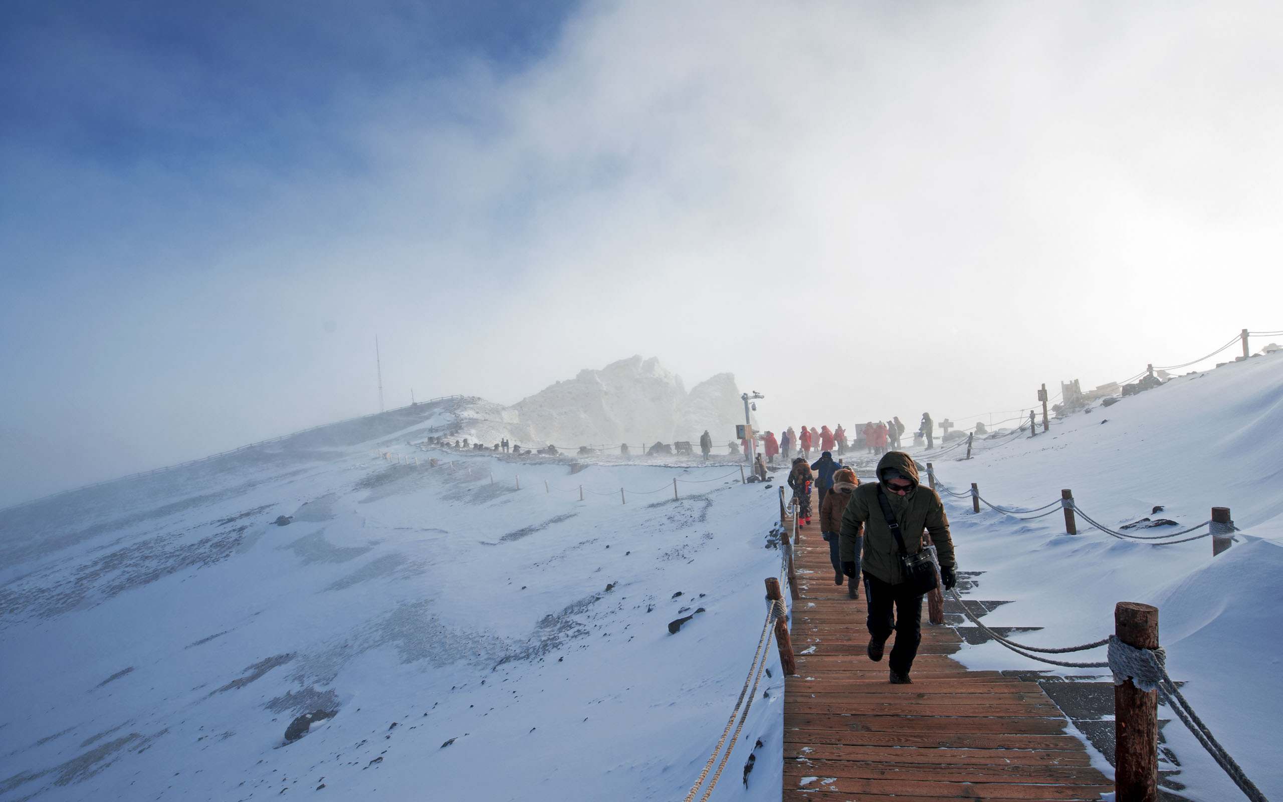
Winter transforms the mountain into an ice kingdom. The waterfall freezes into a curtain of ice. Steam rises from the hot springs through deep snow. The ski resort is legitimate — long runs, cold snow, very uncrowded.
The reality: You almost certainly won’t see Tianchi in winter. The lake freezes, the rim is ice-covered, and fog dominates. Come for the skiing and the frozen landscape, not for the lake.
Card: Spring (April–May)
| Field | Detail |
|---|---|
| Temperature | 5–15°C at base |
| Conditions | Snowmelt, waterfalls at peak flow, trails may be muddy |
| Crowd level | Low |
| Caution | Some high-altitude trails still snow-covered |
Snowmelt feeds the waterfalls, making them thunderous. The forest comes alive with birdsong. But the summit area may still be snow-packed, and Tianchi is often still frozen. A transition season — beautiful at lower elevations, unreliable at the top.
🥾 Climbing & Trails
Card: Summit Climb
| Field | Detail |
|---|---|
| Steps | 1,442 steps from base to summit |
| Vertical gain | ~400 m |
| Time | 1–2 hours on foot |
| Alternative | Shuttle bus ¥85 (~$12) — saves 20–30 min |
| Difficulty | Moderate — steep but well-maintained |
| Altitude | Summit at 2,744 m — altitude sickness unlikely but possible |
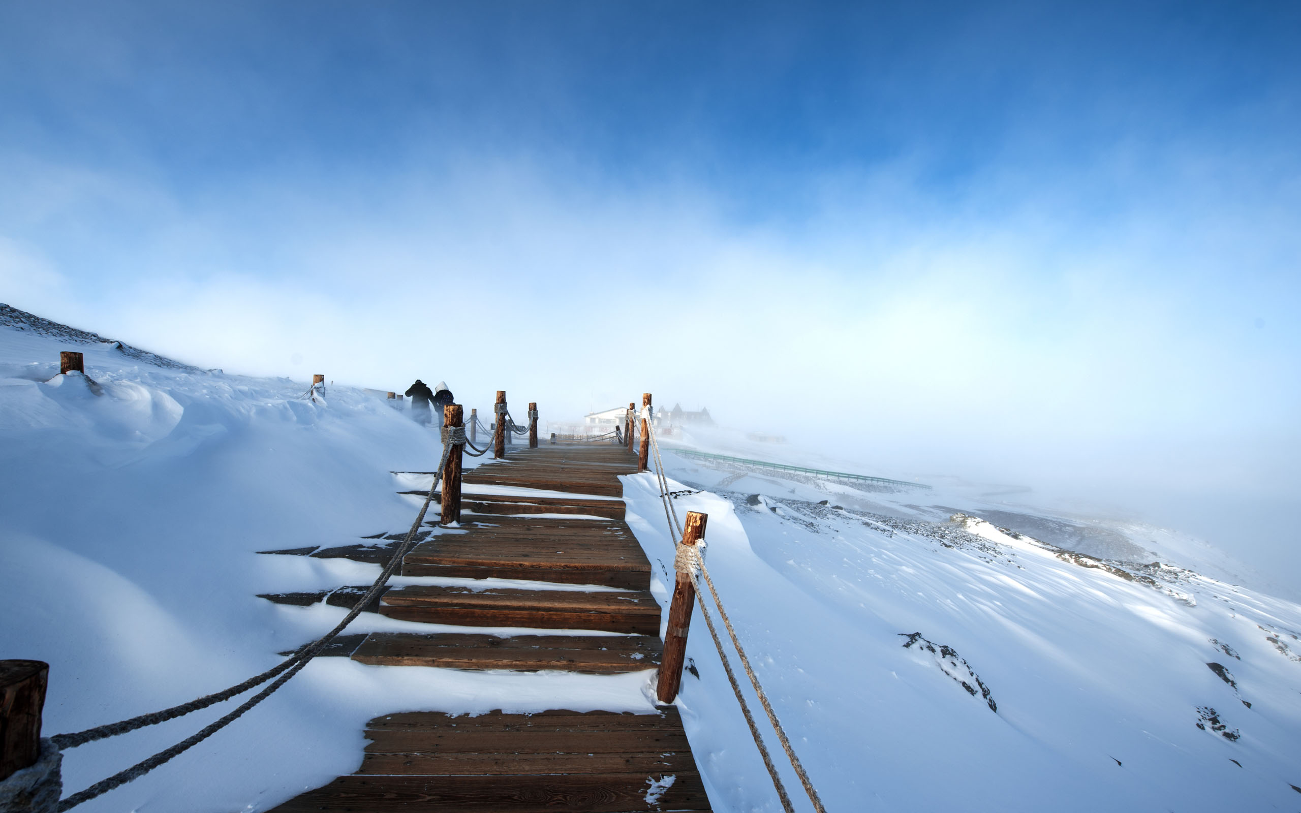
The climb is straightforward — 1,442 concrete steps with rest platforms every few hundred meters. I did it in about 90 minutes at a moderate pace with photo stops. The shuttle bus is an option if your legs are tired, but honestly, the walk up through the forest and birch zone is part of the experience.
At 2,744 m, altitude sickness is rare but not impossible, especially if you’ve just arrived from sea level. Take it slow on the last section. I felt slightly winded but nothing serious.
Tip: The steps are slippery when wet or icy. In shoulder seasons, bring proper footwear — not sandals, not dress shoes. I saw people struggling in flats.
🐾 Wildlife
Card: Animals
| Field | Detail |
|---|---|
| Siberian tiger | Present in the reserve but almost never seen by tourists |
| Sable | Common but shy — listen for movement in the undergrowth |
| Spotted deer | Occasional sightings at dawn/dusk in the forest zone |
| Black bear | Reported occasionally; bear bells available at entrance |
| Bird species | 200+ including black woodpecker, boreal owl |
| Best chance | Early morning, less-traveled trails |
You probably won’t see a tiger. Or a bear. But the forest is alive — sable tracks in fresh snow, woodpeckers hammering birch trunks, the occasional flash of a deer vanishing into the trees. Keep your eyes open and your phone camera ready.
🚗 Getting There
Card: Transport
| Route | Mode | Time | Cost |
|---|---|---|---|
| Beijing → Changbaishan Airport | Flight | 2.5 h | ¥800–2,000 (~$110–280) |
| Shanghai → Changbaishan Airport | Flight | 3 h | ¥1,000–2,500 (~$140–350) |
| Shenyang → Changbaishan Airport | Flight | 1 h | ¥400–800 (~$55–110) |
| Baishan → Changbaishan Gate | Bus | 2 h | ¥50–80 (~$7–11) |
| Changbaishan Airport → Gate | Bus/taxi | 40 min | ¥40–100 (~$5.50–14) |
Changbaishan Airport (NBS) is small but has direct flights from major cities. If flying isn’t an option, take a train to Baishan (白山) or Erdaobaihe (二道白河) and bus the rest of the way. The drive through the forest is beautiful — don’t sleep through it.
Card: Within the Park
| Mode | Route | Cost |
|---|---|---|
| Entrance shuttle | Gate → Sightseeing Center | Included in ticket |
| Sightseeing bus | Lower area → Tianchi base | ¥85 (~$12) |
| Cable car | Summit → Upper viewing area | ¥80 (~$11) |
| Walking | All trails, 15–30 min between sites | Free |
The park has a shuttle system. You buy a sightseeing bus ticket at the entrance, ride up to the Tianchi trailhead, then walk or take the cable car to the summit. Walking between the waterfall and hot springs takes about 20 minutes.
📍 Practical Information
Card: Tickets & Hours
| Field | Detail |
|---|---|
| Peak season ticket | ¥105 (~$15) — July–August |
| Off-peak ticket | ¥85 (~$12) — September–June |
| Sightseeing bus | ¥85 (~$12) — mandatory |
| Cable car | ¥80 (~$11) — optional |
| Opening hours | 6:30 AM–4:00 PM (summer), 8:00 AM–3:30 PM (winter) |
| Total transport cost | ¥165–250 (~$23–35) |
Card: Accommodation
| Type | Price Range | Location |
|---|---|---|
| Budget guesthouse | ¥150–300/night (~$21–42) | Erdaobaihe town |
| Mid-range hotel | ¥400–800/night (~$55–110) | Near park entrance |
| Resort hotel | ¥800–2,000/night (~$110–280) | Changbaishan ski area |
| Park camping | ¥50–100/night (~$7–14) | Designated sites (summer only) |
Erdaobaihe (二道白河) is the most convenient base — a 20-minute drive from the North Gate. It has restaurants, convenience stores, and budget to mid-range hotels. The ski resort area has fancier options if you’re here in winter.
💰 Budget Breakdown
Card: Daily Estimate (Per Person)
| Category | Budget | Mid-Range | Comfort |
|---|---|---|---|
| Entry + transport | ¥190 (~$27) | ¥190 (~$27) | ¥190 (~$27) |
| Accommodation | ¥150 (~$21) | ¥500 (~$70) | ¥1,200 (~$167) |
| Food | ¥80 (~$11) | ¥200 (~$28) | ¥400 (~$56) |
| Misc (eggs, souvenirs) | ¥30 (~$4) | ¥80 (~$11) | ¥200 (~$28) |
| Total | ¥450 (~$63) | ¥970 (~$136) | ¥1,990 (~$278) |
Tip: Eat at the hot spring egg stalls and pack snacks from town. The restaurants near the summit are overpriced and mediocre — I learned that the hard way. A ¥50 box of fried rice that tasted like it had been sitting for an hour.
❓ FAQ
Can I see Tianchi in winter?
Rarely. The lake freezes and is usually covered in snow and fog. The viewing area may be closed due to ice. Come for the frozen landscape, skiing, and hot springs — not the lake.
Is the volcano safe to visit?
Yes. Changbaishan is monitored continuously by the Chinese Academy of Sciences. The last eruption was in 1903, and current activity is limited to minor fumaroles and seismic tremors. The probability of an eruption during your visit is extremely low.
How fit do I need to be?
Moderate fitness. The 1,442-step climb to the summit takes 1–2 hours. If you can climb 30 flights of stairs without stopping, you’ll be fine. The shuttle bus is available if needed.
What should I bring?
- Layered clothing (summit is 10–15°C colder than base)
- Rain jacket (weather changes in minutes)
- Proper hiking shoes (steps are slippery when wet)
- Sunscreen (UV is strong at altitude)
- Cash (some vendors don’t accept cards)
How many days do I need?
One full day to see the main attractions (Tianchi, waterfall, hot springs, birch forest). Two days if you want to explore lower trails, visit the ski resort, or give yourself a second shot at clear weather for Tianchi.
Last updated: July 2026